
Arctic Sea Ice Falls to Year’s Minimum, Satellite Observations Confirm
Arctic Sea Ice Hits Tenth-Lowest Extent in Nearly 50 Years of Records.
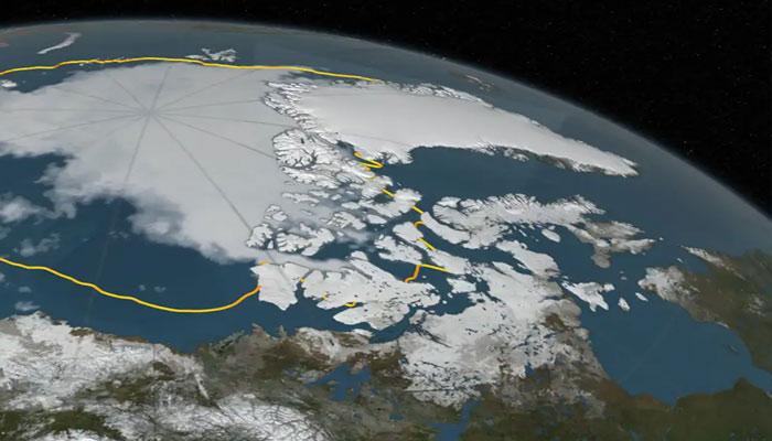
Arctic sea ice has reached its annual summer minimum, with satellites recording an extent of 1.78 million square miles on September 10, 2025—the tenth-lowest level in almost five decades of continuous monitoring.
While not a record low, the figure continues a clear downward trend linked to global warming, according to NASA scientists. Since satellite tracking began in 1978, the Arctic has shown a steady decline in summer ice coverage. The record minimum was observed in 2012, when unusually warm conditions drove ice extent down to 1.31 million square miles.
Researchers note that summer ice levels since 2007 have consistently remained below earlier averages, underscoring how the Arctic has grown thinner, more fragile, and increasingly vulnerable over the past two decades.
Contrasting Antarctic Patterns
In contrast, the Antarctic’s sea ice record tells a more complex story. Although the Southern Hemisphere is now approaching its seasonal winter peak, coverage remains below average. Scientists caution that Antarctic trends are harder to track, as local winds and weather can mask long-term signals.
Still, the nearly 50-year satellite archive provides critical perspective, helping researchers distinguish short-term variability from the broader reality of a warming planet. The 2025 minimum, they say, is yet another reminder that Earth’s icy boundaries are steadily shifting.
Comments are closed.