
Temple, Homes Submerged as Heavy Rain Hits Dehradun: What’s Behind the Deluge?
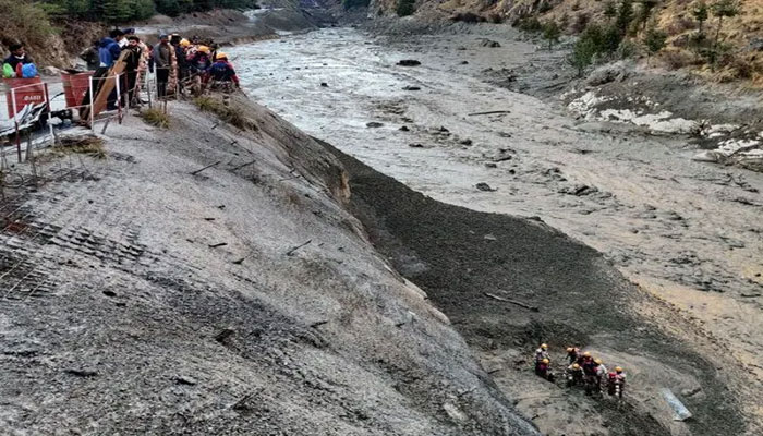
Heavy rainfall lashed Dehradun overnight, submerging homes and temples, washing away a 100-meter stretch of road, and swelling the Tamsa river. The extreme weather has caused significant damage and highlighted the growing impact of climate-related events, including flash floods, cloudbursts, and landslides.
Dr Chander Singh Tomar, Head of the India Meteorological Centre (IMD) in Dehradun, clarified that Monday night’s rainfall cannot be classified as a cloudburst. “A cloudburst involves 100 mm or more of rain in an hour over an area. Dehradun recorded 67 mm per hour, which qualifies as an intense, extreme rainfall spell,” he said.
Mr Tomar explained the phenomenon: “The interaction between easterlies and westerlies—or different air masses over the region—leads to heavy precipitation.” He added that the spell was anticipated and that an orange alert was in place until 8:30 am on September 17.
The IMD warned of continued very heavy rainfall in Dehradun, Nainital, and Champawat, and heavy rainfall in Chamoli, Udham Singh Nagar, Bageshwar, and Pithoragarh.
Since the start of the monsoon on June 1, Uttarakhand has recorded 1,343.2 mm of rainfall—22% above normal. Bageshwar district has received 239% surplus rainfall. IMD experts note that such variations, whether surplus or deficit, are part of normal monsoon patterns.
Contrastingly, Yaspal Sundriyal, former head of geology at HNB Garhwal University, attributed such extreme events to climate change. He explained that intersecting air masses create “triple junctions,” resulting in intense rain, thunderstorms, and strong winds. Sundriyal also noted that while overall rainfall has decreased over time, extreme rainfall events are increasing, leading to flash floods as large amounts of rain fall in hours rather than days.
Comments are closed.