
Could Northeast India Face a Nepal-Like Disaster? Experts Warn of Climate, Dam Risks

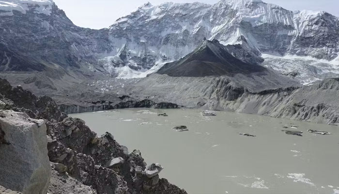
The devastating glacier-related disaster near the Nepal-Tibet border has once again highlighted.
The growing risks facing the Himalayan region as climate change alters its fragile mountain environment. The August 26 disaster sent huge volumes of water, mud and debris downstream, destroying settlements, infrastructure and hydropower facilities. More than 1,200 people have reportedly died, while thousands remain missing.
The scale of the destruction has also raised concerns in India’s ecologically sensitive Northeast, where retreating glaciers, expanding glacial lakes, extreme rainfall and extensive hydropower infrastructure are creating a complex web of risks.
Sikkim’s warning sign
Sikkim is among the states facing particularly serious glacial risks. Authorities have identified 40 high-risk glacial lakes in the state, including 16 classified in the highest-risk Category A.
The danger was demonstrated in October 2023, when the South Lhonak glacial lake breached its natural barriers and triggered a devastating Glacial Lake Outburst Flood (GLOF). The surge travelled through the Teesta river system and destroyed the Teesta III hydropower dam at Chungthang, killing dozens and damaging roads, bridges and other infrastructure.
The incident showed how an event originating high in the mountains can rapidly develop into a major disaster hundreds of kilometres downstream when communities and critical infrastructure are concentrated along river valleys.
Climate change is intensifying the threat
Rising temperatures are transforming the Himalayan cryosphere. As glaciers retreat, meltwater can contribute to the formation and expansion of glacial lakes, many of which are held back by unstable natural barriers.
These barriers can fail because of heavy rainfall, landslides, avalanches, earthquakes or other triggers, releasing large quantities of water in a matter of minutes. The resulting floods can sweep through narrow valleys carrying rocks, mud and other debris, dramatically increasing their destructive force.
Scientists have increasingly identified retreating glaciers and expanding glacial lakes as major hazards in a warming Himalaya, with northeastern India also facing significant GLOF exposure.
More broadly, a warmer Himalaya could increase the likelihood of cascading events involving floods, landslides, avalanches and unstable slopes.
Why hydropower projects matter
The Northeast has some of India’s largest untapped hydropower potential, leading to a concentration of dams and related infrastructure across Himalayan states.
Hydropower projects do not themselves trigger GLOFs, but they can increase the potential consequences when extreme events occur. A sudden flood can damage dams, tunnels, diversion structures, roads and transmission networks, while the failure of one piece of critical infrastructure can disrupt an entire river basin.
The recent disaster in Nepal has brought that vulnerability into sharper focus, with hydropower facilities damaged and workers reportedly trapped in tunnels.
For northeastern India, experts say the lesson is that risk assessments should extend beyond individual projects and examine entire river basins and the interconnected infrastructure within them.
The threat goes beyond glacial floods
Glacial hazards are only one part of the Northeast’s vulnerability. The region is already highly exposed to landslides, flash floods, extreme rainfall and earthquakes.
This means the next major disaster may not necessarily begin with a GLOF. Extreme rainfall could trigger a landslide, destabilise an already vulnerable mountain slope and damage infrastructure, creating a chain reaction involving several hazards at once.
Climate change could make such combinations increasingly difficult to predict using historical weather and disaster patterns.
Early warning systems crucial
The Nepal disaster has renewed attention on the need to monitor vulnerable glacial lakes and strengthen early-warning mechanisms.
In Sikkim, authorities are exploring measures such as controlled drainage of high-risk lakes, improved drainage systems, plug walls and tunnels. Satellite imagery and remote-sensing technologies can also help track changes in glacial lakes and surrounding terrain.
But monitoring alone cannot eliminate the danger. Experts say disaster planning must also account for where settlements, roads, bridges, power plants and other critical infrastructure are located.
Balancing development with ecological safety
For the Northeast, the challenge is to expand energy and infrastructure without increasing exposure in an already fragile Himalayan environment.
Large construction projects in steep and geologically unstable areas can amplify the consequences of landslides and floods when environmental safeguards and risk assessments are inadequate. Climate change adds another layer of uncertainty, as past weather patterns may no longer accurately represent future conditions.
The key lesson from Nepal is therefore not simply that glaciers are melting. It is that climate change, unstable mountain terrain, rivers and concentrated infrastructure can interact to create cascading disasters whose impact is far greater than that of any single hazard.
For northeastern India, experts have stressed the need for basin-wide risk assessments, continuous monitoring of dangerous glacial lakes, stronger early-warning systems, climate-resilient infrastructure and greater coordination between states and neighbouring countries.
The next disaster may not mirror Nepal’s exactly. But unless preparedness and planning improve, the combination of vulnerable glaciers, unstable terrain, powerful rivers and critical infrastructure could leave the Northeast exposed to a catastrophe on a similar scale.
Comments are closed.